
The Geography of Italy
 Italy is a Mediterranean country located in southern Europe.
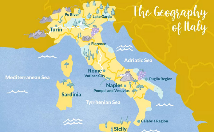
The Italian mainland is a long peninsula that resembles a tall boot, so much so that the country is often referred to as “the boot,” with the Puglia region in the southeast being the “heel of the boot” and the Calabria region in the southwest being the “toe of the boot.”
The Climate in Italy
 Italy is known for its Mediterranean climate, which is mainly on the coast.
The Map of Italy
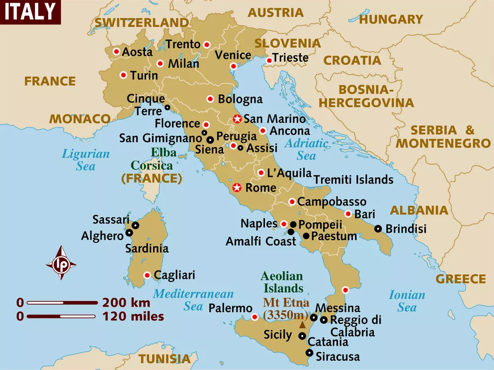 The area of Italy is 301,340 sq km, including the islands of Sardinia and Sicily, making it just slightly larger than the state of Arizona in the USA. The tiny sovereign nations of Vatican City and San Marino are enclaves within Italy.
Italy is divided into 20 different regions, including the islands of Sicily and Sardinia in the Mediterranean Sea which are each a separate region.
Italy’s population is a little over 60,400,000 people. The largest Italian city is Rome, with a population of 4.2 million people. Rome is also the capital and heads the list of top Italian cities to visit.
Italian Mountain Ranges and Volcanoes
 About 40% of Italy’s land is mountainous, offering great places to ski in winter and hike in summer.
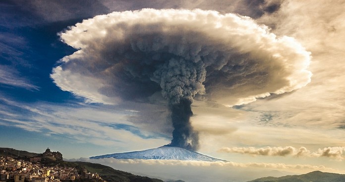
Mount Vesuvius, in southern Italy near Naples, is the only active volcano on the European mainland. It was Vesuvius that buried the famous Roman city of Pompeii, whose ruins are a popular tourist site. On the island of Sicily, Mount Etna, also still active, is one of the world’s largest volcanoes.
Rivers and Lakes in Italy
 The rivers in Italy correspond to some of the major tourist destinations. The Po River starts in the Alps in the north and flows eastward from the city of Turin to the east coast and the Adriatic Sea, going through the very fertile Po Valley. At the river’s end, the Po Delta is an interesting place to visit.
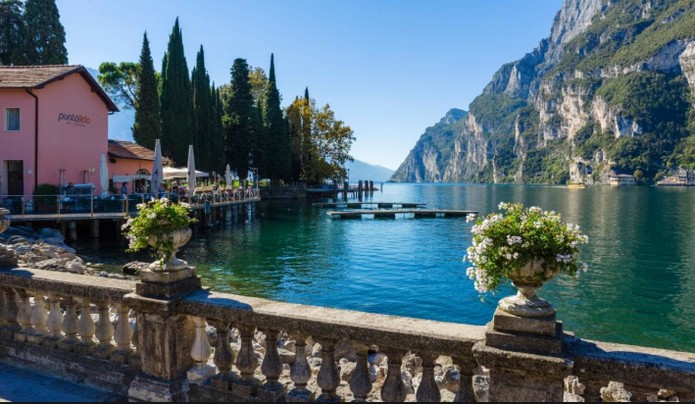
Italy has many lakes, especially in the northern part of the country. Lake Garda is the largest Italian lake, with a distance around the lake of 158 kilometers, or about 100 miles.


")


")


