
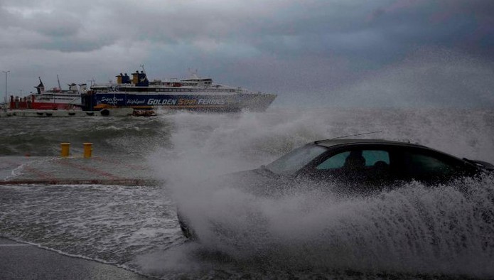
 People in Italy and Greeceare bracing themselves for a rare and powerful hurricane-type storm in southern Europe’s Mediterranean region, due to hit this weekend.The storm, often called a “Medicane” (Mediterranean + hurricane) has many features similar to tropical hurricanes and typhoons.
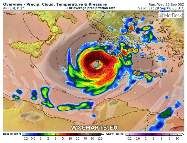 The current storm, triggered flash flooding across Tunisia and Libya over the past few days before moving north over the Mediterranean towards Europe.In fact, it will be a very violent Storm, with tropical connotations: it will be decidedly hot due to a rise of North African desert air accompanied by huge amounts of dust and sand from the Sahara, and the winds will even exceed 160km/h in the Sicily Channel and 140km/h on most of the Center / South..
During the day of Tuesday, the bad weather will rise all over Italy, also affecting the Center / North with torrential rains and strong sirocco winds on the Adriatic that will cause a new high water event in Venice
The system is expected to move over the Ionian Greek Islands and southern Greece before picking up speed and heading into Turkey.


 – Italian Cuisine by Cities")


